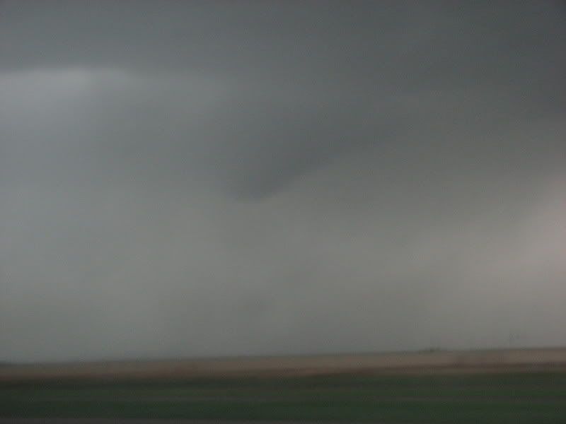
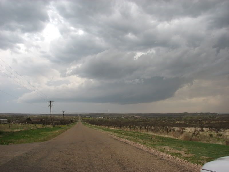
So we went west some more, and then south to intercept our first storm, just north of Hereford. The rotation was incredible. The winds going into this storm were extremely intense. 50mph or higher at times. We struggled to keep up, but violent rotation made it evident that a tornado was imminent(haha). As we were trying to parallel it, what appeared to be a possible wedge tornado(unconfirmed) appeared quite a ways west of us in a rain core. I cannot confirm that this was a tornado, but i have never seen a rain shaft take on that shape. This was not a part of the tight circulation that was almost directly overhead. It was about 8 miles west of us. As we headed north towards I40, a strange wall cloud developed about 1/2 mile to our west. It wasn't attached to the base of the meso, but the upward motion made it clear to me that it was indeed a wall cloud. as it rose upward into the base, it had a cork-screw appearance. It was literally twisting like a corkscrew. Then as it flattened out a little, a stinger of a funnel peaked out. about 1/2 way to the ground. Which wasn't far, because the wall cloud was so low. The funnel dissappeared, and the storm looked more an more sluggish. The road options northeast were not possible, so we opted to go through a small rain/hail core to get east of the line. This is when a huge ordeal set in for us and many others. All radar information, whether internet or satellite, would stop loading for at least 20 minutes. This was not good. We didn't know it was not good, as we were just heading through a small rain core. What we didn't know was that there was a developing tornado directly south of I40. We didn't see it on radar because there were no new updates. As we were just getting out of the small hail core, a small vortex of trash debris and tumbleweeds spun up literally 50 feet in front of us into the median, then we spotted more circulation about 15 yards south of us, and it blasted right into us. It was the scariest chase moment of my life.(until May 4th) Might it have been just a gustnado fest on top of us? Nope. As we got east, I looked back and saw the funnel about 1/2 to the ground, and lifting, with debris still spinning. The pics were blurry. We kept heading east, and I got better pictures of a bowl-shaped funnel. So we were directly in the middle of a multi-vortex rain-wrapped tornado. Luckily, it was weak. Someone else had to have seen it. From the east side. We weren't the only ones there. When the radar updated, there were 2 tvs' right over I40 at the exact time we had driven through it(RADAR CAPTURE BELOW). Scary. We got east of everything, and decided to wait on a low-precipitation cell that had developed south of the line. The meso of this storm was incredible. Zero precip. and spinning like a top. My first trueLP supercell. At this point, with damage reports coming in from the Tulia storm, we wanted to get east of this line before that cell crossed I40. Joey decided against it as it was moving fast enough to barrel into us. So we waited. Then as it started moving east, away from the line, we headed east to try and squeeze between the cell and the line. This was another of the most stressful chase situations I have ever been in. It sucked. Semi-trucks were crowding the roadways. Spraying water everywhere, everytime we thought we were almost out of the Heavy precip. the radar would update and kill our spirits. After an at least an hour, we emerged slowly from the line, got far enough ahead of it to get gas, some quick snacks, and bust out ahead of it again. The line started to die and the rest of the way home was gravy. Then I got home, and there was a party already in progress at my apartment. Then everyone there separately asked me how it went. I was tired, angry, sad, excited, and angry again. All at once. So I told everyone there to shut up so that I could sleep, and that anyone who kept me from sleeping would get their ass handed to them.