
I keep punching S through Osage Co and eventually cross the Arkansas River on the worst bridge I had ever seen. I mean, had there not been a tornado reported on the ground, I wouldn't
have crossed this bridge. The whole way across I was white-knuckling the steering wheel. So i get across the bridge, and turn W to intercept the wall cloud. It was very nice.

I get to within about 2 miles and stop in a good clearing. It displayed very good motion and finally debris becomes visible. Tornado #1

So I call 911 and report it, and take off to the West to get closer to it. It picks up for a minute, then puts down another tornado, that went from just debris to wedge in a matter of seconds. Tornado #2

I blast through some stop signs to get even closer, hoping it will cross the road within 1/2 of a mile of me. It picks up again and I set up about a mile E of the wall cloud. It cycles for a few minutes, then spins up a skinny little rope for about 10 seconds, then its gone. Tornado #3

About a minute later, a rather large cone funnel appears but isn't on the ground. It had the "Im gonna be a multiple-vortex monster" look to it, but only spun up one quick debris swirl before dying out. Tornado #4

after another 2 minutes of good motion, a nice stovepipe hits the ground within 2 seconds of appearing. #5

It quickly grows into a fat cone with multiple-vortices screaming around it.

This was a strong tornado, luckily it was in a rural area. I keep filming while repositioning, following it N up muddy-ass county roads. The Meso becomes smaller and smaller and eventually wraps itself around the top of the now truncated-cone-stinger. At this point, the tornado was coming sideways out of the updraft, and then dropping straight down to the ground.

With a new meso to the E, I watch this bad boy rope out, and reposition to the E. Theres already a tornado on the ground with this new meso when I find a clearing. So I set the camera up and let it capture the next few tornadoes. Tornado 7 happens and dissipates while #6 rages on

#7&8

#8 ropes out and 9 appears
#7&9

cycling again
and the #7 still going as the storm is moving out of reach.

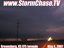
342 miles. What a day. My video of #2 and #5 was aired on KTUL, and then on The Weather Channel, numerous ABC platforms such as GMA, and World News Tonight. I also sold it to the Associated Press, who aired it on CNN Headline News. Over 6800 miles without a good tornado will make you feel like its a bad year, then with one slow-moving cyclic-supercell, the season is salvaged.
Disclaimer:For the haters and neigh sayers, there were actually 9 different tornadoes. Not 5 tornadoes that skipped a few times. If I counted tornadoes like that(some people do) there would have been over 15. Some didn't show any visible damage during surveys. Some people say that the 7th tornado was on the ground for over an hour.
No comments:
Post a Comment