Saturday, August 18, 2007
Hurricane Dean
well. Hurricane Dean, more than likely, will tear the hell out of Jamaica as a strong catagory4 or maybe even a 5 and then move across the Gulf of Mexico. hopefully it will track more north than expected. Our houses are built a lot sturdier than those on the Mexican gulf coast. Oh, who am I kidding. I just want it to track north so that we can get some good video from TX.

Friday, August 17, 2007
new
well i had an account at chaseblogs.com but that didnt work out. awesome. so now i have lost most of my pictures and chase reports for this year and i am exteremly excited to get to re-do them. so this is a work in progress. stay tuned. even though no-one cares.
Saturday, May 5, 2007
May 4th Greensburg, KS
Wow. What a bittersweet chase for us. Randy Rhea and I basically farted our way west slowly waiting for storms to go up. I didn't want to wait for the south cells to move into our area, so we just tried to keep from getting bored and held our ground. It paid off. We were heading west toward the new cell west of Coldwater when we heard the first TOR warning. The only equipment we had was a weather radio. So we were already scared. Night chasing with no radar is not a good idea. So we're about 8 miles east of Coldwater flying west when we hear the first funnel reports. SHOWTIME! Not even 2 minutes later that funnel turned into a large tornado with a small(er) tornado forming under a new meso. Well, that newer "small" tornado grew at an alarming rate. As we were turning north onto 183 in Coldwater, we could see the southern area of circulation, and it looked iffy. We get up onto a hill, to see a large cone to the west, and a growing stovepipe on the east side of the updraft base. With each lightning flash, the stovepipe grew into a moster. Absolutely massive. We were at least 10 miles away and it was a beast. As we got closer, the western tornado weakened, but at least 2 satellite tornadoes were dancing around the wedge. There were at least 4 on the ground at this time, 2 strong ones. My buddy Randy Hicks was very close to these tornadoes and saw 6 at once. 2 more satellites on the north side of the wedge. As we followed it north, it only got bigger. At one point, it looked like it was wrapping up in rain. We stopped, i got out and took some pictures, and it looked at least 1.5 miles wide. we were more than 5 miles south of it and it takes up the whole frame. We continued to follow it north as it went through Greensburg. We were sure the roads were blocked due to significant damage, so we tried to take a county road around town. Bad idea. Stuck in the mud. With a new meso trying to funnel to our west. Luckily, we're awesome, so we got unstuck, and got the hell out of there. We watch a new wedge move NE and decide we can't catch it(we thought it was the same one, but damage paths and radar say otherwise). Then we decided to go home, due to damage reports and basically knowing we couldn't get to it. We left the wx-radio on just to hear damage reports. It produced numerous strong tornadoes for somewhere around 5 hours. Amazingly there were only 12 confirmed deaths as Greensburg sustained a direct hit. The warning system won the battle tonight. 95% of the town was destroyed, and only 12 people lost their lives. thats amazing to me. Props to Mike Umshied, the Warning coordinator for the NWS in DDC. He was in touch with spotters and issued a "Tornado Emergency" for Greensburg and saved countless lives. Its just amazing how well the spotters, chasers, NWS, and local TV Mets worked together tonight. If the warning system worked this well all the time, tornado deaths could be cut in half.
Another death was confirmed as an on-duty police officer was spotting around Macksville. The damn tornado was so big he didn't know it was there. He died protecting his town and he is a hero. Our hearts and prayers go out to all of those affected by this outbreak.


Another death was confirmed as an on-duty police officer was spotting around Macksville. The damn tornado was so big he didn't know it was there. He died protecting his town and he is a hero. Our hearts and prayers go out to all of those affected by this outbreak.


Sunday, April 22, 2007
Texas panhandle April 21st, 2007
Well, Chris Wilburn, Joey Ketckem, and Russel Parsons picked me up around 7am and we headed for Amarillo, TX. We sat at a rest stop for at least an hour waiting on stuff to fire up. We talked to a lot of people who wanted to know about possible storms. Watched a guy do yoga. Watched a rabbit hop into a hole. No storms. So we moved and waited some more. No storms. Then a tornado watch was issued. A special watch, known as a p.d.s.(particularly dangerous situation) which are rare and are only issued when large violent tornadoes are possible.
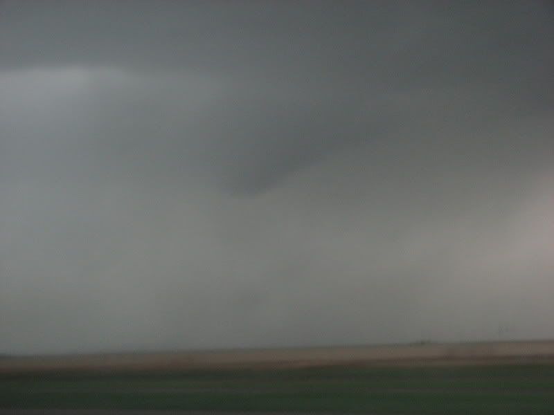
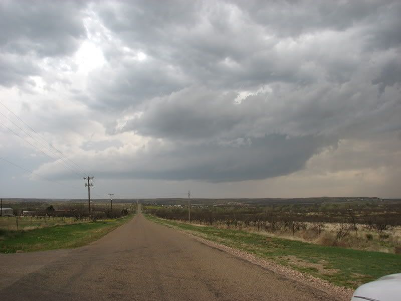
So we went west some more, and then south to intercept our first storm, just north of Hereford. The rotation was incredible. The winds going into this storm were extremely intense. 50mph or higher at times. We struggled to keep up, but violent rotation made it evident that a tornado was imminent(haha). As we were trying to parallel it, what appeared to be a possible wedge tornado(unconfirmed) appeared quite a ways west of us in a rain core. I cannot confirm that this was a tornado, but i have never seen a rain shaft take on that shape. This was not a part of the tight circulation that was almost directly overhead. It was about 8 miles west of us. As we headed north towards I40, a strange wall cloud developed about 1/2 mile to our west. It wasn't attached to the base of the meso, but the upward motion made it clear to me that it was indeed a wall cloud. as it rose upward into the base, it had a cork-screw appearance. It was literally twisting like a corkscrew. Then as it flattened out a little, a stinger of a funnel peaked out. about 1/2 way to the ground. Which wasn't far, because the wall cloud was so low. The funnel dissappeared, and the storm looked more an more sluggish. The road options northeast were not possible, so we opted to go through a small rain/hail core to get east of the line. This is when a huge ordeal set in for us and many others. All radar information, whether internet or satellite, would stop loading for at least 20 minutes. This was not good. We didn't know it was not good, as we were just heading through a small rain core. What we didn't know was that there was a developing tornado directly south of I40. We didn't see it on radar because there were no new updates. As we were just getting out of the small hail core, a small vortex of trash debris and tumbleweeds spun up literally 50 feet in front of us into the median, then we spotted more circulation about 15 yards south of us, and it blasted right into us. It was the scariest chase moment of my life.(until May 4th) Might it have been just a gustnado fest on top of us? Nope. As we got east, I looked back and saw the funnel about 1/2 to the ground, and lifting, with debris still spinning. The pics were blurry. We kept heading east, and I got better pictures of a bowl-shaped funnel. So we were directly in the middle of a multi-vortex rain-wrapped tornado. Luckily, it was weak. Someone else had to have seen it. From the east side. We weren't the only ones there. When the radar updated, there were 2 tvs' right over I40 at the exact time we had driven through it(RADAR CAPTURE BELOW). Scary. We got east of everything, and decided to wait on a low-precipitation cell that had developed south of the line. The meso of this storm was incredible. Zero precip. and spinning like a top. My first trueLP supercell. At this point, with damage reports coming in from the Tulia storm, we wanted to get east of this line before that cell crossed I40. Joey decided against it as it was moving fast enough to barrel into us. So we waited. Then as it started moving east, away from the line, we headed east to try and squeeze between the cell and the line. This was another of the most stressful chase situations I have ever been in. It sucked. Semi-trucks were crowding the roadways. Spraying water everywhere, everytime we thought we were almost out of the Heavy precip. the radar would update and kill our spirits. After an at least an hour, we emerged slowly from the line, got far enough ahead of it to get gas, some quick snacks, and bust out ahead of it again. The line started to die and the rest of the way home was gravy. Then I got home, and there was a party already in progress at my apartment. Then everyone there separately asked me how it went. I was tired, angry, sad, excited, and angry again. All at once. So I told everyone there to shut up so that I could sleep, and that anyone who kept me from sleeping would get their ass handed to them.


So we went west some more, and then south to intercept our first storm, just north of Hereford. The rotation was incredible. The winds going into this storm were extremely intense. 50mph or higher at times. We struggled to keep up, but violent rotation made it evident that a tornado was imminent(haha). As we were trying to parallel it, what appeared to be a possible wedge tornado(unconfirmed) appeared quite a ways west of us in a rain core. I cannot confirm that this was a tornado, but i have never seen a rain shaft take on that shape. This was not a part of the tight circulation that was almost directly overhead. It was about 8 miles west of us. As we headed north towards I40, a strange wall cloud developed about 1/2 mile to our west. It wasn't attached to the base of the meso, but the upward motion made it clear to me that it was indeed a wall cloud. as it rose upward into the base, it had a cork-screw appearance. It was literally twisting like a corkscrew. Then as it flattened out a little, a stinger of a funnel peaked out. about 1/2 way to the ground. Which wasn't far, because the wall cloud was so low. The funnel dissappeared, and the storm looked more an more sluggish. The road options northeast were not possible, so we opted to go through a small rain/hail core to get east of the line. This is when a huge ordeal set in for us and many others. All radar information, whether internet or satellite, would stop loading for at least 20 minutes. This was not good. We didn't know it was not good, as we were just heading through a small rain core. What we didn't know was that there was a developing tornado directly south of I40. We didn't see it on radar because there were no new updates. As we were just getting out of the small hail core, a small vortex of trash debris and tumbleweeds spun up literally 50 feet in front of us into the median, then we spotted more circulation about 15 yards south of us, and it blasted right into us. It was the scariest chase moment of my life.(until May 4th) Might it have been just a gustnado fest on top of us? Nope. As we got east, I looked back and saw the funnel about 1/2 to the ground, and lifting, with debris still spinning. The pics were blurry. We kept heading east, and I got better pictures of a bowl-shaped funnel. So we were directly in the middle of a multi-vortex rain-wrapped tornado. Luckily, it was weak. Someone else had to have seen it. From the east side. We weren't the only ones there. When the radar updated, there were 2 tvs' right over I40 at the exact time we had driven through it(RADAR CAPTURE BELOW). Scary. We got east of everything, and decided to wait on a low-precipitation cell that had developed south of the line. The meso of this storm was incredible. Zero precip. and spinning like a top. My first trueLP supercell. At this point, with damage reports coming in from the Tulia storm, we wanted to get east of this line before that cell crossed I40. Joey decided against it as it was moving fast enough to barrel into us. So we waited. Then as it started moving east, away from the line, we headed east to try and squeeze between the cell and the line. This was another of the most stressful chase situations I have ever been in. It sucked. Semi-trucks were crowding the roadways. Spraying water everywhere, everytime we thought we were almost out of the Heavy precip. the radar would update and kill our spirits. After an at least an hour, we emerged slowly from the line, got far enough ahead of it to get gas, some quick snacks, and bust out ahead of it again. The line started to die and the rest of the way home was gravy. Then I got home, and there was a party already in progress at my apartment. Then everyone there separately asked me how it went. I was tired, angry, sad, excited, and angry again. All at once. So I told everyone there to shut up so that I could sleep, and that anyone who kept me from sleeping would get their ass handed to them.

Friday, April 13, 2007
2 day chase-cation. kind of.
Well. Randy Rhea and I drove 1152 miles this past 2 days. Road trips with Randy are always fun. However, for a high-risk, i feel kind of empty...
Thursday(slight-risk) we went out west with hopes of catching 1 or 2 very low-precipitation supercells. We got to Shamrock, TX in the panhandle, went south towards Childress. Watched and followed some BS multi-cluster storms. Saw a decent looking base with a "wall cloud." Weak upward motion. Not bad considering lack of moisture. As it got dark, lightning picked up, and we got excellent footage/pics. Watched lightning for an hour, then started our 3 hour drive to Decatur to set up for the high risk Friday.
Friday morning we decided to play the dryline/TriplePoint. There were storms firing early out west toward Wichita Falls. I was absolutely sure that this wouldnt be the main show. Tony Laubach and his crew caught an elusive wedge around Seymour, TX. that storm went to crap shortly after as the storms went linear. the center section of the line started to grow ahead. The cell moving through Ft. Worth looked very interesting. I have seen many embedded "supercells" but this one was different. It had propagated out ahead of the line enough to develop a hook. So we drove 75 miles through the north suburbs of DFW to get ahead of this one cell. Sat and waited for it to cross whatever lake is just east of Rockwall. watched it come in, dropped south ahead of the cell, found a clearing, saw what appeared to be a rain-wrapped wallcloud. Saw 2 or 3 powerflashes under it. i reported it to NWS. We're calling it a tornado since i found some reports of tornado damage in that area. the DFW local weather office sucks at doing reports so I'm not even going to try and find it. Got East to a gas station to let it pass over. Got hailed on. I was interviewed by tyler texas' nbc station. link: http://www.ketknbc.com/home/ticker/7025557.html
so. 1152 miles, for some lightning pictures, a possible rain-wrapped tornado, and some hard to swallow lessons.
1. Go with your gut. This means if you think you should be setting up west of the risk area, do it. We missed out on a 1/4 mile wide wedge tornado. We would have been there had we stayed the night in Wichita Falls.
2. Even professional severe storm meteorologists can and will be wrong. For some reason, there was a high risk issued. All the upper-air dynamics were there for a huge tornado outbreak. the shear profiles were more than favorable for large and violent tornadoes. long-track violent tornadoes. But for some reason it all went to hell.
3. Never chase in a metroplex area. With larger populations come larger population of idiots on the road.
4. Leave early. Always leave early. A lot of things can go wrong. Especially when you're depending on wifi.
Thursday(slight-risk) we went out west with hopes of catching 1 or 2 very low-precipitation supercells. We got to Shamrock, TX in the panhandle, went south towards Childress. Watched and followed some BS multi-cluster storms. Saw a decent looking base with a "wall cloud." Weak upward motion. Not bad considering lack of moisture. As it got dark, lightning picked up, and we got excellent footage/pics. Watched lightning for an hour, then started our 3 hour drive to Decatur to set up for the high risk Friday.
Friday morning we decided to play the dryline/TriplePoint. There were storms firing early out west toward Wichita Falls. I was absolutely sure that this wouldnt be the main show. Tony Laubach and his crew caught an elusive wedge around Seymour, TX. that storm went to crap shortly after as the storms went linear. the center section of the line started to grow ahead. The cell moving through Ft. Worth looked very interesting. I have seen many embedded "supercells" but this one was different. It had propagated out ahead of the line enough to develop a hook. So we drove 75 miles through the north suburbs of DFW to get ahead of this one cell. Sat and waited for it to cross whatever lake is just east of Rockwall. watched it come in, dropped south ahead of the cell, found a clearing, saw what appeared to be a rain-wrapped wallcloud. Saw 2 or 3 powerflashes under it. i reported it to NWS. We're calling it a tornado since i found some reports of tornado damage in that area. the DFW local weather office sucks at doing reports so I'm not even going to try and find it. Got East to a gas station to let it pass over. Got hailed on. I was interviewed by tyler texas' nbc station. link: http://www.ketknbc.com/home/ticker/7025557.html
so. 1152 miles, for some lightning pictures, a possible rain-wrapped tornado, and some hard to swallow lessons.
1. Go with your gut. This means if you think you should be setting up west of the risk area, do it. We missed out on a 1/4 mile wide wedge tornado. We would have been there had we stayed the night in Wichita Falls.
2. Even professional severe storm meteorologists can and will be wrong. For some reason, there was a high risk issued. All the upper-air dynamics were there for a huge tornado outbreak. the shear profiles were more than favorable for large and violent tornadoes. long-track violent tornadoes. But for some reason it all went to hell.
3. Never chase in a metroplex area. With larger populations come larger population of idiots on the road.
4. Leave early. Always leave early. A lot of things can go wrong. Especially when you're depending on wifi.
Subscribe to:
Posts (Atom)